
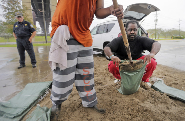
 St. Charles Parish, La., resident Jarmar Gross, right, holds a bag as a prison trustee fills it with sand at the West Bank Bridge Park in Luling as preparations continue for Hurricane Nate on Saturday, Oct. 7, 2017. (Brett Duke/NOLA.com The Times-Picayune via AP)
Coastal residents from Louisiana to the Florida panhandle are bracing for the effects of fast-moving Hurricane Nate, expected to hit sometime Saturday night – likely with Category 2 strength.
The National Hurricane Center in Miami projected that Nate would brush by the southeast tip of Louisiana, near the mouth of the Mississippi River, around 7 p.m. Saturday (0000 GMT Sunday).
A late Saturday landfall projected for the Mississippi Gulf Coast posed a multitude of threats, including heavy rain, high tides and strong winds.
The eye of #Nate is becoming visible on New Orleans/Slidell radar. Catch the latest advisory at https://t.co/tW4KeGdBFb pic.twitter.com/jG9VhadRIX
— National Hurricane Center (@NHC_Atlantic) October 7, 2017
Louisiana Gov. John Bel Edwards said he spoke with President Trump on Saturday morning.
“He assured me that LA would have all the assistance we need as we prepare for #Nate,” the governor posted on Twitter.
Edwards told residents in areas that will be affected by Nate to be where they want to be to ride this storm out by 3pm.

Boats from communities along the outer shorelines are stacked into the Violet Canal for safe harbor in Violet, La., in preparation for Hurricane Nate, expected to make landfall on the Gulf Coast, Saturday, Oct. 7, 2017. (AP Photo/Gerald Herbert)
States of emergency were declared in Louisiana, Mississippi and Alabama; officials announced evacuation orders in low-lying areas and the opening of shelters for anyone who needs them.
As often happens when storms approach, waterside sections of New Orleans, outside the city’s levee system, were under an evacuation order.
About 2,000 people were affected. But not everyone was complying.
Anticipation of Nate’s high winds, rain and storm surge forced several low-lying areas to evacuate, including the barrier island town of Grand Isle, and the coastal town of Lafitte.
The vast majority of New Orleans residents were not under such an order.
But a 7 p.m. curfew was declared for the city, whose fragile pumping and drainage system could face a major test once Nate strikes.
System weaknesses – including the failure of some pumps and power-generating turbines – were exposed after an August 5 deluge flooded homes and businesses in some sections of the city.
Forecaster said Nate could dump 3 to 6 inches (7 to 15 centimeters) of rain on the region – with isolated totals of up to 10 inches (25 centimeters).
Storm surge was as big a worry as rain.

The back of a car is filled with bags of sand at the West Bank Bridge Park in Luling as St. Charles Parish, La., residents prepare for Hurricane Nate on Saturday, Oct. 7, 2017. Forecasters say an intensifying Hurricane Nate is now expected to be a Category 2 hurricane at landfall on the central Gulf Coast in coming hours. (Brett Duke/NOLA.com The Times-Picayune via AP)
As is often done during the approach of storms, the city ordered evacuation of some low-lying communities near the water and its levee system – an estimated 1,000 homes.
And communities along the Gulf and near Lake Pontchartrain were looking at the possibility of storm surge flooding.
Nate was located at 10 a.m. CDT Saturday about 180 miles (285 kilometers) south-southeast of the mouth of the Mississippi River. It was still a Category 1 storm but was expected to gain strength before making landfall.
Nate has already killed at least 21 people in Central America.
Story by the Associated Press.